Explore one hour and beyond from Orbost
Orbost is a gateway town to a magnificent sweep of national parks and state forests: East Gippsland is one of the very few places in Australia where native forest in an extraordinary array of diverse landscapes stretches from our highest alpine peaks right to the ocean. Orbost provides a perfect base for exploring the mountains and hinterland to the north and the Wilderness Coast to the east.
Exploring these areas safely requires some thought and preparation: be aware that there may be little to no mobile phone coverage, fuel or food supplies available to be purchased. Ensure that you have sufficient supplies for your trip, and that you are accessing local and emergency information to stay aware of local conditions at all times.
Head to our Download Tour Brochures page for pdf brochures covering these locations.
Mountains and Hinterland Orbost Region
To the north of Orbost lie the forested foothills and ranges through which the Snowy River carves it's way to the sea. Almost all this area is National Park or State Forest, with pockets of grazing land and tiny remote communities. In a small area there is an extraordinarily diverse array of landscapes: from the peaks of the Alpine National Park, the 1000 m deep wild Snowy River Valley to the cool temperate rainforest of the Errinudra Plateau.
Download a self guide tour brochure " Orbost to McKillops Bridge..." for a guide covering the principal route to access these areas.
Buchan Caves (50 minutes)
Buchan is a pretty little town sitting on the river of the same name, surrounded by green rolling hills but best known for it's caves. Buchan Caves Reserve has a number of beautiful caves open daily for public tours: the reserve itself is an arboretum of mature exotic and native species. Read more.
Tulloch Ard Gorge Walk ( 1 hour 15 minutes)
Continue north of Buchan on the Barry Way to Gelantipy, then turn off onto Tulloch Ard Road for 12 km. A 3.2 km return walk is rewarded by spectacular view up the heart of the wild Snowy River valley and over the cliff faces of the gorge. Download a self guide tour brochure.
Alpine National Park ( 2 hours plus)
The East Gippsland sections of the Alpine National Park include the Cobberas, Limestone Creek, Native Dog Flat, Suggan Buggan and Mount Tingaringy areas. These are wild remote places which get just a handful of visitors daily at the most. Well prepared travellers will be rewarded scenery that includes rocky mountain peaks, sweeping views, alpine meadows, snowgums and majestic valleys. Read more on the Parks Victoria page - look for the guide to "Benambra, Buchan and Bonang".
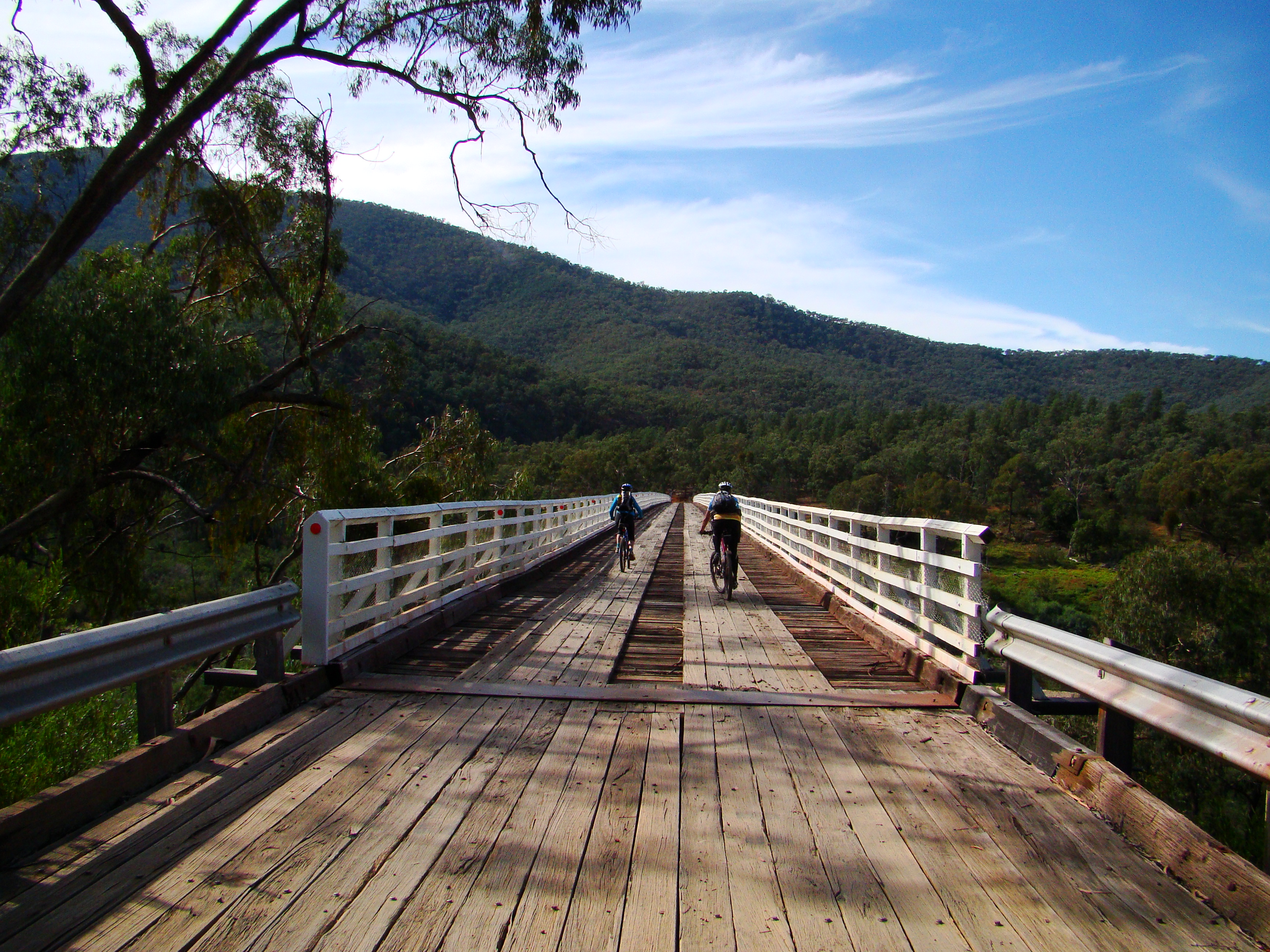
McKillops Bridge (2 hours)
Travelling to McKillops Bridge from the Barry Way (west of the bridge) is one of the most adventurous drives in Australia, with a long winding descent on a very narrow gravel road.The approach from the Bonang Road (east of the bridge) is a gentler drive.
The bridge is a striking structure, spanning a wild river and surrounded by mountains, while it's height above the river speaks to the size of the floods that have raged here. Bush camping and basic picnic facilities are available - bring everything you need with you. Download a self guide tour brochure.
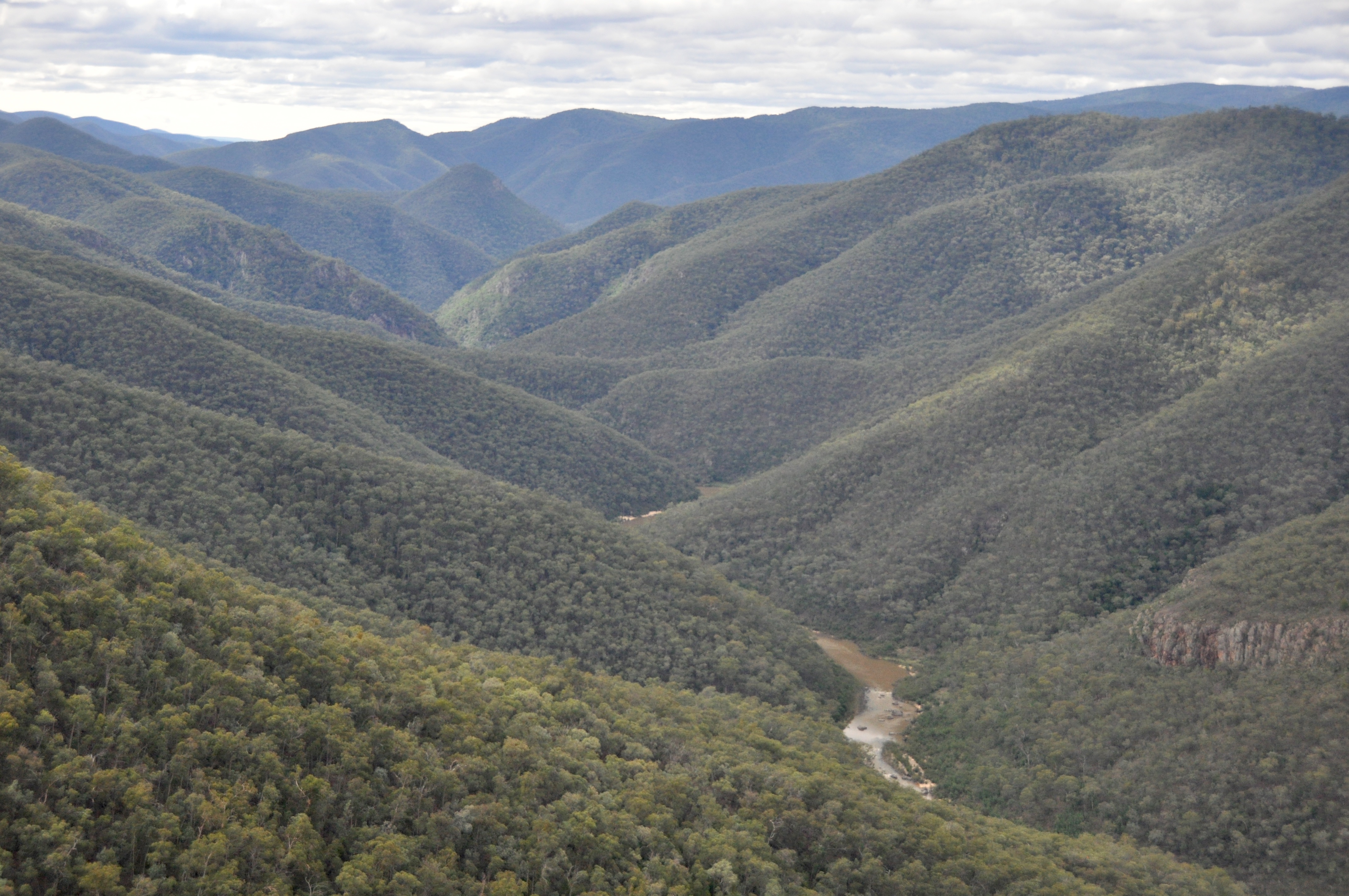
Errinundra National Park (2 hours)
Accessed most easily from the Bonang Road, this high altitude national park preserves a unique mixed cool temperate rainforest found now where else, featuring Errinundra Shining Gums, Southern Sassafras, black oliveberry and a rare form of Mountain Plum Pine. In November stands of Gippsland Waratah are covered in large crimson blossoms. Download a self guide tour brochure. ("Errinundra Saddle Rainforest Walk...")
Wilderness Coast and East, Orbost Region
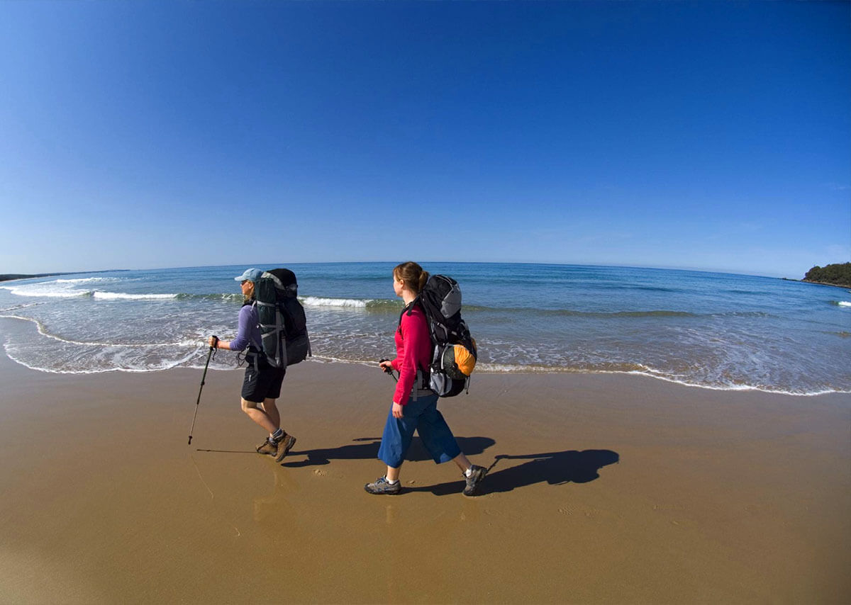
The "Wilderness Coast" of eastern Victoria stretches from Cape Conran through to Mallacoota, then beyond northward into NSW. It is an immense stretch of beaches and rocky headlands fringed by native forest, and it is right on Orbost's doorstep.
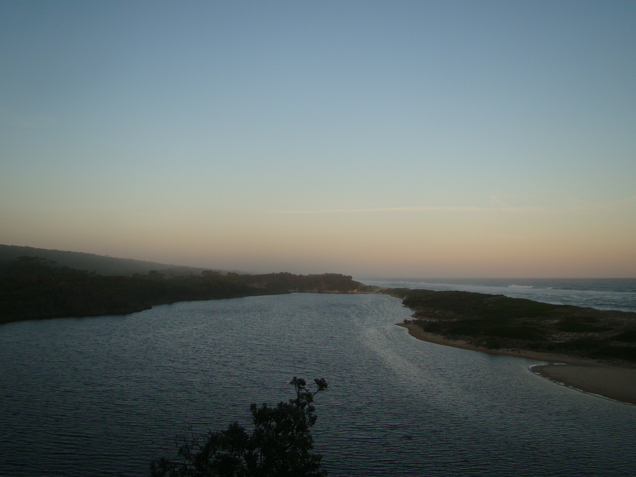
Bemm River and Sydenham Inlet ( 45 min drive)
The little township of "Bemm" sits where the river of that name joins the wide waters of Sydehnam inlet. With accommodation, a pub and general store it is a haven for anyone who loves fishing or a quiet place to get away amongst nature on the coast. Pearl Point and other ocean beaches within Cape Conran Coastal Park are accessed from the town of Bemm River.
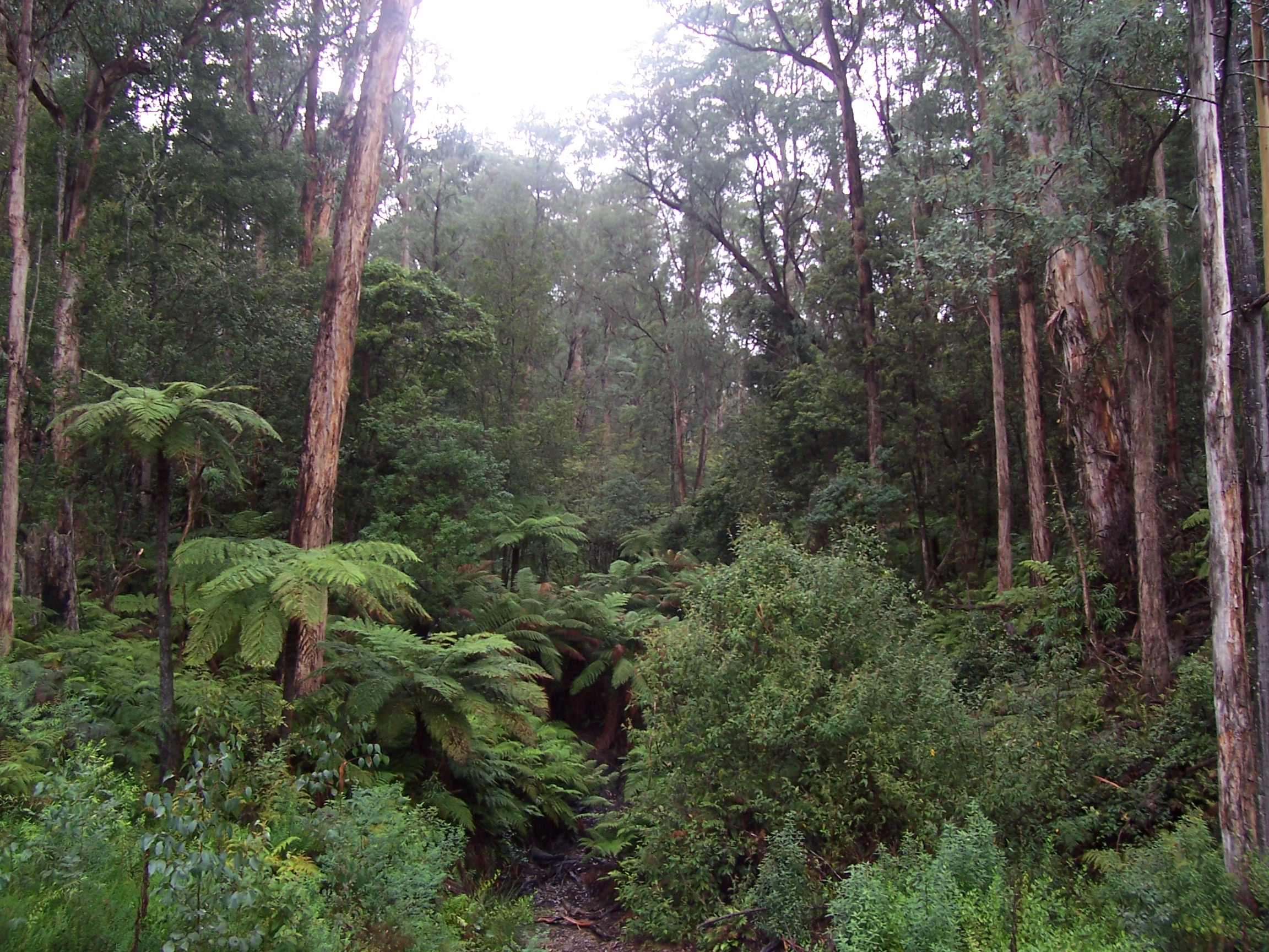
McKenzie River Rainforest Walk ( 45 minutes)
This is an exquisite little rainforest walk, right next to the Princes Hwy and so easy to get to it is a shame to pass it by.
*Note that this walk is still awaiting repair after the Black Summer bushfires is and is not yet re-opened. *
Croajingalong National Park ( 1 - 2 hours)
Croajinglong National Park covers the easternmost coastal area of Victoria, conserving the coastline - including Point Hicks, Thurra River, Wingan Inlet - and the forested hills adjacent. This area was significantly impacted by the Black Summer bushfires, so please check the Parks Victoria website for more information if planning a visit to the area.